Lowther River Project - Bampton

Working Together for a Resilient Future

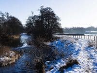
The River Lowther is a beautiful and cherished feature of the Bampton landscape, flowing through farmland and close to the heart of the village.  However, recent flood events have highlighted the growing challenges posed by climate change.

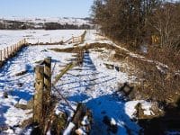
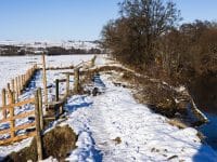
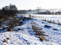
In February 2024, the river breached its banks causing a significant collapse behind Bampton Memorial Hall. This was following two named storms – Isha and Jocelyn – in the previous month. This breach impacted farmland, disrupted a public footpath and raised concerns about future flood resilience.

Cumbria Connect is working with landowners, community members, agencies and hydrological experts to explore potential solutions.  Independent hydrological consultants, Dynamic Rivers, are conducting in-depth studies to provide a robust evidence base for future decision-making.

Community involvement & next steps

In November, a drop-in consultation event in Bampton – hosted by Cumbria Connect, Eden Rivers Trust and Dynamic Rivers – brought together over 50 members of the community to share knowledge, concerns and ideas.

The valuable input gathered at this event has been collated to:

  • Support Dynamic Rivers’ ongoing hydrological studies.
  • Inform discussions with relevant local agencies and authorities.
  • Help shape a collaborative approach to managing future flood risks.

Community Questions & Agency Responses

During the November 2024 drop-in event, members of the community raised important questions about the River Lowther and its management. We have gathered responses from the relevant agencies to provide further clarity.

Flooding

Q. Environment Agency flood event records look to be inaccurate, as current very high winter flood is occurring 5-6 days per year, not the stated 1-3 days. Why?

A. If referring to the historic flood map, any inaccuracies might be down to a lack of reporting of flooding having occurred for us to add to the mapping. We would welcome opportunities to update and improve the accuracy of these flood maps.

Environment Agency

Impact on roads, drains and bridge infrastructure

Q. Can we predict impact to infrastructure, particularly on the three bridges in the village? 

A. Yes.  We will build these structures in detail in our model and review shear stress, velocity and water levels at these structures to understand energy and pressure exerted on them for a range of predict flood frequencies.

Dynamic Rivers.

Q. What should we do if trees are blocking bridges at Bampton?

A. We would encourage residents to report any blockages.

Environment incident hotline – (24 hour service) 0800 80 70 60.

Where they are occurring in the vicinity of a bridge, it is unlikely to be an Environment Agency responsibility to clear any damage.  This would sit with local authority highways.

Westmorland & Furness Council emergency out of hours – 0300 373 3300

Environment Agency

Q. Environment Agency budget has been cut for strategic removal of debris. Why?

Although overall funding for the Environment Agency has not reduced, the amount of available budget to fund flood risk management activities, including maintenance of channels, has been constrained due to increasing costs.

Decisions on which activities to fund, will always be taken based on the risk of flooding to properties, with the activities protecting the most properties being prioritised.

Environment incident hotline – (24 hour service) 0800 80 70 60

Q. Drains along the road are often blocked and need clearing who is responsible for this?

A. In the UK, local councils or highway authorities are responsible for maintaining road drains under the Highways Act 1980, which requires them to keep highways safe and drainage systems functional. Councils often have dedicated drainage teams for regular inspections, cleaning, and emergency repairs. You can contact Westmorland & Furness Council by calling their helpline – 0300 373 3300

Environment Agency

Repairing the bank and dredging the river

Q. Do we know when the embankment was built?

Sections appear on the first OS maps dating from 1860, with other embankments appearing in the 1890 edition. Their heights at this time are not known.

It is likely that all embankments will have been raised to provide a 5 year standard of protection to agricultural land (as calculated at the time) by the Ministry of Agriculture, Fisheries and Food (MAFF) sometime between the 1950s and the 1970s. They appear generally to be constructed of river dredged material and as such their resilience to flood erosion on the floodplain face is limited and local failures are becoming increasingly common.

Dynamic Rivers

Q. If the river banks were taken down would it make any difference?

It would alter the amount of times river water wets the floodplain and in doing so it would rejuvenate many of the features on the floodplain that are currently over-dry compared to natural. The spreading of water will also lead to a reduction in energy in the main river with gravel deposition likely as a result. This level of storage will be modelled for its impact on flooding in Bampton and presented at the workshops.

Dynamic Rivers

Q. Can we not dredge the river?

A. Dredging of a main river would need a Flood Risk Activity Permit from the Environment Agency, and if on an Ordinary Water Course a Flood Defence Consent from the Local Authority.

The river Lowther is a special place for nature, celebrated by being recognised as a Site of Special Scientific Interest (SSSI). Natural England would need to be contacted for their advice on any application that is within or close to a SSSI.  It is unlikely that dredging would be permitted, as dredging is a listed operation that could damage the site’s features of interest.

Environment Agency

Q. How much would it cost to repair the bank? (£10,000)? Could this be a stop-gap solution?

A. It would probably be of that order, but it would only be a stop-gap. The river has breached here before due to the planform (the shape and geometry of the river) and the position of the old channels nearby.  It will breach again here and elsewhere without a more significant and ongoing maintenance commitment.

Dynamic Rivers

Q. Does gravel in the river system contribute towards river flooding?

Gravel deposition will impact on the frequency of flooding locally.  In our models, we will be running a dredging option to demonstrate the flooding from the river with and without these gravel deposits.

Dynamic Rivers.

Q. Are tree stumps and gravel on the other side of the river pushing water across it?

A. We assume this is at the breach site. Breaching is linked to the fact that the outer bend in the river here is very close to an old river route which the river is trying to get back into.

Gravels naturally accumulate on the inside of bends if not removed as this is a lower energy area with peak flow velocities directed around the outside bend. As such the deposition is a consequence of the bend in the river, not a cause.

The embankments were not designed to resist extreme floods and flow over their crest at the breach point has seen material progressively erode from the floodplain side until a full breach has occurred.

Dynamic Rivers

Impact at Carlisle

Q. How much land is going to be needed to protect Carlisle from flooding?

Most of the city is well protected and we are continuing to work on schemes which will improve the level of protection available to the city and its residents.

Environment Agency

Q. What impact will climate change have on our rivers?

The Eden Catchment is projected to be impacted significantly by climate change. Latest projections suggest an increase in peak river flows in Eden of 18% by 2039, 27% by 2069 and up to 47% by the ned of the century.

Environment Agency

Hydrological modelling

Q. Does high tide affect the velocity of the river?

We are too far from the coast and too high an elevation for this to have an effect at Bampton Grange.

Dynamic Rivers

Q. Do the hydrological models take into account surface water?

No, it doesn’t. We could investigate any known surface water problem and can discuss this at the workshops.

Dynamic Rivers

Q. Are we modelling river force as well as volume?

River energy indexed via shear stress can be modelled and is indicative of river force and its potential to cause erosion and deposition. This is something that could be explored during the workshops.

Dynamic Rivers

Q. Can we look more into the Knipe area specifically?

We are reviewing the impact of any proposed and past works on the Knipe area and can present this at the workshops.

Dynamic Rivers

Q. What are our data sources for river/rainfall/runoff and how do we increase that accuracy?

Hydrology inputs have been generated using standard UK methods i.e. ReFH2 and WINFAP-FEH. These are statistical methods and also integrate gauged information from local catchments to increase accuracy.

Regarding available rainfall records, some have already been supplied by those living in the local area and these will be reviewed together with the nearest EA rainfall gauge records.

As further local rainfall or river flow data may not be available to calibrate the model, it may not be possible to further improve the accuracy, but comments from the local public on predicted flood extents and depths is valuable here.

River geometry is based on LiDAR supplemented by information from site walkover.  The data is considered to be accurate. Any discrepancies identified during the consultation will be investigated with additional survey or walkover observations.

Dynamic Rivers

Slow the flow

Q. Should we be holding more water or moving it off downstream quicker? Do we need to lower the water table as it’s too oversaturated?

This is a complex question as flow enters the main river from diffuse surface routes, ditches, drains and tributaries and it is their reaction time that is critical to flooding.

Saturated land results in widespread but slow surface flow compared to faster flows in ditches and drains and the rougher vegetation enhances this slowing when compared to flows seen across grazed, improved grassland. We will try and demonstrate this complex interaction at one of the workshops using examples, past studies and our model.

Dynamic Rivers

Q. Does ‘slowing the flow’ make everything else back up? How big is the zone of influence up river?

It can cause backing up, with the degree of impact upstream being dependant on the slope of the valley. Water levels increase but are likely to be below that held within floodbanks. The impact is dependent on where the slowing occurs.  If it is upstream of Bampton then impacts will be to fields and not housing.

We will present example data from other schemes and bespoke modelling of this effect at one of the workshops

Dynamic Rivers

Q. Can slowing the flow upstream help issues at the breach site?

Slowing the flow upstream will impact on water levels along the river downstream in a flood and this would include at the breach site.

Dynamic Rivers

Q. Where’s the evidence for the benefits of trees?

We will present a review of the evidence, which is mixed, at the workshops.

Dynamic Rivers

Q. Are tree stumps and gravel on the other side of the river pushing water across it?

A. We assume this is at the breach site. Breaching is linked to the fact that the outer bend in the river here is very close to an old river route which the river is trying to get back into.

Gravels naturally accumulate on the inside of bends if not removed as this is a lower energy area with peak flow velocities directed around the outside bend. As such the deposition is a consequence of the bend in the river, not a cause.

The embankments were not designed to resist extreme floods and flow over their crest at the breach point has seen material progressively erode from the floodplain side until a full breach has occurred.

Dynamic Rivers

Farming

Q. How can farmers on the floodplain be supported in the future?

A. Government support for farmers is being directed to delivering public goods such as flood prevention and biodiversity. Floodplains are multi-use landscape and the Government’s Environmental Land Management Schemes can be used to provide an alternative income streams for farmers on the floodplain.

Cumbria Connect Team

Q. We used to get a 12-hour warning at Haweswater to take livestock out before overtopping. This has stopped, but could it be brought back?

Thank you for raising this.  Our investigations indicate that this was a local, informal understanding and was not formally documented.  We acknowledge the importance of such proactive measures and will explore this further.

United Utilities

Reservoirs

Q. How does control of the water at Haweswater Reservoir affect things?

A. Haweswater is a crucial drinking water reservoir, supplying a significant portion of the region, making its management critical.

To mitigate flood risks, we manage inflows and regulate water storage carefully. When levels approach half a meter below top water level, we turn away indirect catchment intakes and, when possible, manage flows from Wet Sleddale to prevent additional inflows. However, natural runoff from the direct catchment (spanning 3,208 hectares of the total 9,050-hectare catchment) remains outside our control. The stringent operating rules, agreed upon with the Environment Agency and the Drinking Water Inspectorate, ensure we balance flood prevention, water supply reliability, and ecological considerations effectively. 

United Utilities

Q. Could United Utilities reduce reservoir levels?

Reducing reservoir levels is challenging due to several factors: 

  • Weather patterns and inflows: Wet Sleddale’s catchment area (1,848 hectares, including How Gill, Thornship, Keld, Lanshaw, Tailbert, and Swear Gill) feeds into the reservoir, meaning levels are heavily influenced by rainfall. If inflows are high, levels may rise despite management efforts.
  • Water supply and environmental regulations: The reservoir supports downstream river habitats, with a compensation flow of approximately 35 Ml/d during November and December. Releasing excessive water could disrupt natural watercourses and affect ecosystems.
  • Flood risk and operational considerations: Wet Sleddale provides regulated releases to the River Lowther to help maintain ecological balance. If too much water is released at once, it could increase flood risks or reduce available water during dry periods.

Q. Could you decrease the water volume at Wet Sleddale?

A. Decreasing the water volume at Wet Sleddale Reservoir is not straightforward, as its primary function is now water bank storage rather than direct transfer to Haweswater.

The reservoir is used to release water into the River Lowther during summer and autumn months to support river habitats and fish migration. While abstraction to Haweswater is still permitted, it has been reduced due to poor water quality, particularly high levels of Dissolved Organic Carbon (DOC). Any adjustments to water levels would need to be carefully managed within existing environmental and operational constraints.

United Utilities

Q. Drinking water quality standards at Wet Sleddale. How does this impact water management between reservoirs?

A. The high levels of Dissolved Organic Carbon (DOC)* at Wet Sleddale mean that water is rarely transferred to Haweswater. Instead, it is discharged into the River Lowther. DOC complicates the treatment process at Watchgate Water Treatment Works, requiring more intensive treatment and increasing operational challenges and costs. As a result, Wet Sleddale functions mainly as a water bank storage system, releasing water into the river rather than being a primary source for drinking water supply 

United Utilities

*DOC are the amount of carbon-containing compounds that are naturally dissolved in water including rivers, lakes, and oceans, originating from the breakdown of dead plants and animals.

Q. Cawdale Reservoir has been going over the top in the last few years as the gullies aren’t being cleared out. Why?

A. There is no reservoir at Cawdale; instead, there is a weir where the natural flow of water should push vegetation downstream.

These sites are regularly checked, and if a blockage occurs, contractors are arranged to clear it. If anything, a blockage at Cawdale would divert the water away from Haweswater and down the river where the compensation flows.

United Utilities

Q. We used to get a 12-hour warning at Haweswater to take livestock out before overtopping. This has stopped, but could it be brought back?

Thank you for raising this.  Our investigations indicate that this was a local, informal understanding and was not formally documented.  We acknowledge the importance of such proactive measures and will explore this further.

United Utilities

Funding

Q. How much would it cost to repair the bank? (£10,000)? Could this be a stop-gap solution?

A. It would probably be of that order, but it would only be a stop-gap. The river has breached here before due to the planform (the shape and geometry of the river) and the position of the old channels nearby.  It will breach again here and elsewhere without a more significant and ongoing maintenance commitment.

Dynamic Rivers

Q. How would any works be funded?

A. We are not at the funding stage yet, as we are still wanting to work with the various stakeholders in the valley to identify the shared problem and how that can be addressed. Depending on the outcome of that preparatory work we can then explore what potential funding options may be available.
Cumbria Connect Team

Q. How much money is coming into partners through Cumbria Connect?

A. Cumbria Connect is a nature recovery programme funded through the Endangered Landscapes & Seascapes Programme. Our funders scrutinise our expenditure to ensure that we only finance support projects that deliver results contributing to the aims of projects. This includes a broad range of organisations including local rivers’ trusts and farmers through grants.

You can find out more about our work, projects and who we work with on exploring our website  connectfornature.org.uk

Cumbria Connect Team

Stay involved

Thank you to everyone who has contributed so far.  Your local knowledge is helping to shape a more informed and resilient future for the River Lowther.

We will continue to provide updates as more information becomes available.